August 20, 2026
A Layered History of the Joel M. Pritchard Building
ARC Fellow: Evelyn Newman
Degree Program: Health Services – Community Practice; Urban Design & Planning
Faculty Advisors: Dylan Stevenson (Urban Design and Planning)
Firm: DLR Group
Firm Advisors: B Sanborn, Erica Ceder
Project dates: Autumn 2024 – Spring 2025
Explore the Story Map
Click to Watch the Presentation
Click to View the Presentation Slides
More about the project:
Pritchard Building, which formerly served as the Washington State Library, was designed by Paul Thiry and completed in 1958. It was sited to integrate with the historic Legislative, Cherberg, and O’Brien buildings on the State’s Capitol Campus in Olympia, Washington. The site is currently listed on the National Register of Historic Places from 1958 – 1959, specifically for its place in the cultural landscape of the Capitol and its value as a significant work of mid-century modern architecture. The objective of this project is to deepen the understanding of the Pritchard Building as a historically significant site by providing a more comprehensive account of the diverse groups and communities that have contributed to its history. This is accomplished through a two-pronged approach: conducting archival research in collaboration with librarians and scholars specializing in Pacific Northwest historical records, and integrating personal narratives gathered from local community-based organizations and cultural centers. The project aims to offer a fuller, more nuanced portrayal of the Pritchard Building’s role in the social and cultural fabric of region, by combining spatially based historical changes with primary sources, personal stories and lived experiences. This work will contribute to a more inclusive and accurate representation of the building’s past, highlighting its significance to a broader range of communities than previously documented.
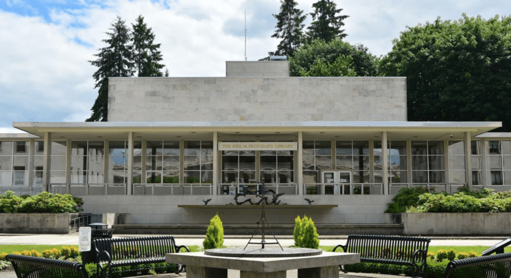
The Joel M. Pritchard Library, 2010. WASHINGTON STATE ARCHIVES.
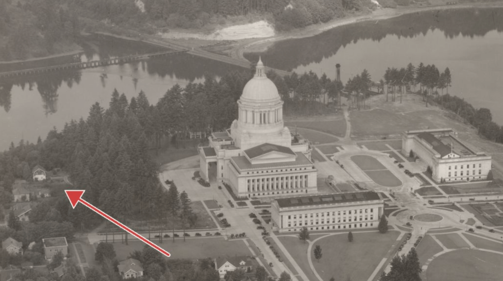
Arrow indicating location of former residences on the site prior to Pritchard Building construction; image at right shows the area in the 1940s after homes were demolished and replaced with a parking lot. WASHINGTON STATE ARCHIVES.
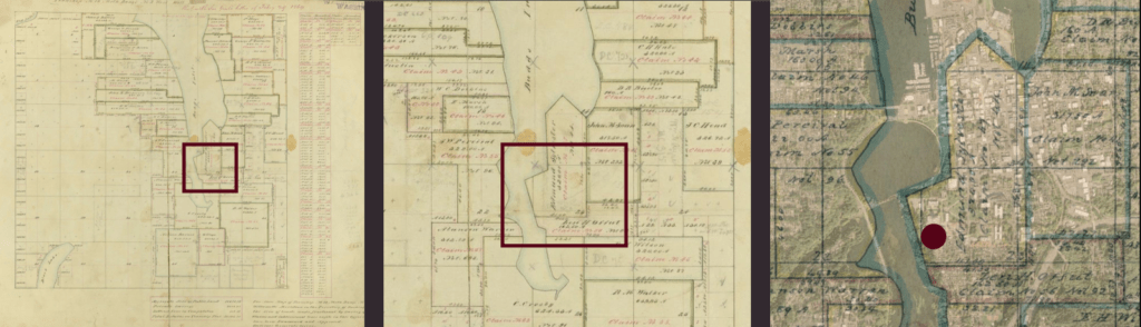
Spatial analysis using digital and geo-referenced maps in GIS. BUREAU OF LAND MANAGEMENT.
